Convert ArcGIS Indoors to IMDF

File Geodatabase
right-arrow
室内映射数据格式
Start a Free Trial

Transform ArcGIS Indoors File Geodatabase to IMDF for iOS Applications

Esri’s ArcGIS Indoors Information Models (AIIM) use the file geodatabase format to store data. With FME you can take specific building layers or other venue data including many vector types and convert them into IMDF for viewing in iOS applications like Apple Maps. IMDF models will help your visitors understand their surroundings and give them the ability to control their mobile navigation system.

Unlock Your FileGDB Building Information

Large venues need to ensure that navigational tools are available to as many visitors as possible. By converting your ArcGIS Indoors data to IMDF with FME, all iOS and Apple Maps users will be able to easily view information about each hallway, room, and corner of your venue. While visitors are having an exciting time exploring, you can analyze foot traffic and movement throughout your facility.
Scenario: Victoria Airport Esri GDB to IMDF

ArcGIS Indoors Zoom
FME Server 2017

Automate FGDB to IMDF Transformations

It is important that your visitors always have the most up-to-date version of your venue’s floor plan. Supplying accurate floor plans can be difficult as buildings often undergo renovations with stores or offices being moved. With FME Server you can automate your ArcGIS Indoors FGDB conversions to IMDF so that public building models are accurate and ready to go.
Learn More About FME Server

We’re Here to Help!

一个公司nversion like this sounds complicated, right? Don’t worry! Our intuitive drag-and-drop interface is easy to use and does not require any coding. Take a look at ourArcgisindoorstoimdf.模板来了解如何设置工作区以操纵并将文件转换为IMDF。使用免费IMDF Validatortool to make sure your data is set up and ready to use in Apple Maps. If you have further questions, don’t hesitate to ask our experts!

FME YVR Airport

Common Conversions

FME lets you integrate many applications and file formats. Here are some of the ways our users convertFile Geodatabaseand室内映射数据格式.


About

File Geodatabase

Esri File Geodatabase is single-user GIS database framework for a desktop environment. It uses a local file structure for easy access and management of spatial data.

Learn More

室内映射数据格式

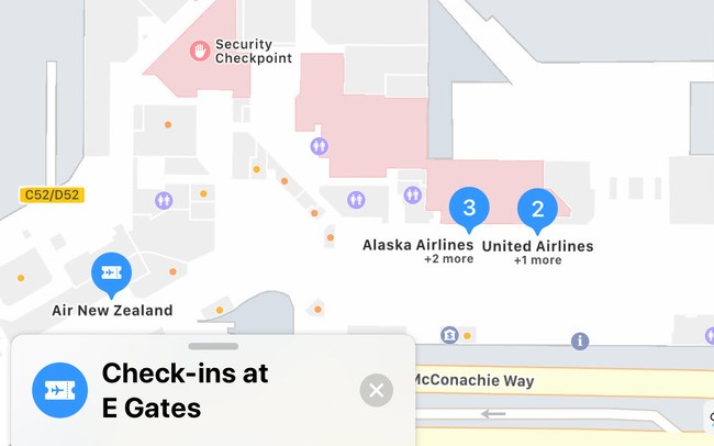
IMDF is an indoor mapping data standard supported by applications like Apple Maps. Use of this format helps businesses enable wayfinding inside their venues.

Learn More

FME

FME is the data integration platform with the best support for spatial data. Save time by using its drag-and-drop interface to connect data from hundreds of formats and applications, transform data in limitless ways, and automate virtually any data workflow.

Learn More

Try FME Desktop

No credit card necessary. Start integrating data today!