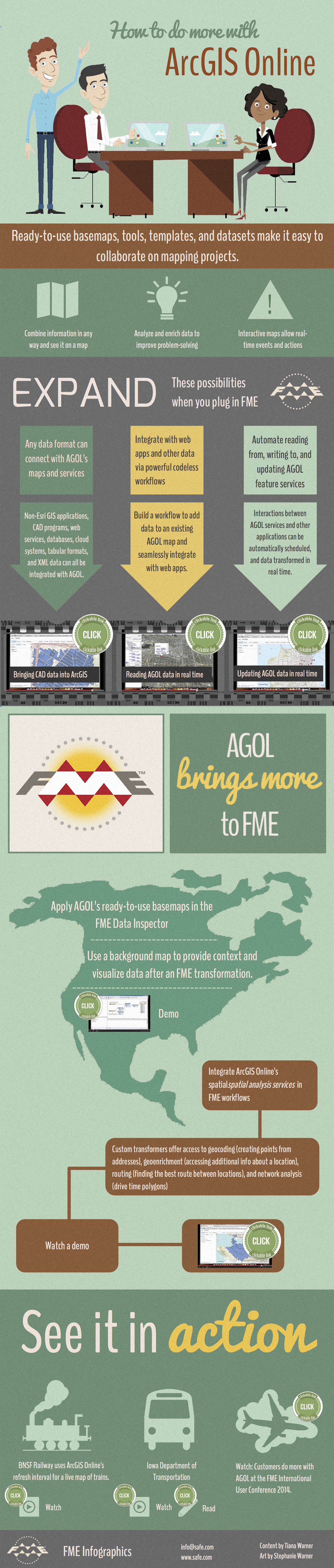
ArcGIS Onlineis Esri’s web-based mapping platform that lets you instantly create andsharespatial information. Below are a few ways to do even more withthis powerful service, including sophisticated data integration, workflow automation, and real-time updates.
| Click the videos in the image to see demos, or view the resources at the bottom of this post. |
Resources
Demo: Bringing CAD data into ArcGIS
Demo: Reading AGOL data in real time
Demo: Updating AGOL data in real time
Demo: Applying an AGOL basemap in the FME Data Inspector
Demo: Leveraging AGOL services
Video: BNSF Railway
Video: Iowa DOT
Blog: Iowa DOT
Videos and slides: ArcGIS Online at the FME UC

Tiana Warner
Tiana is a Senior Marketing Specialist at Safe Software. Her background in computer programming and creative hobbies led her to be one of the main producers of creative content for Safe Software. Tiana spends her free time writing fantasy novels, riding her horse, and exploring nature with her rescue pup, Joey.


